


- About Us
-
Other Offices
Division / District
Ministry/Division & Department
- e-Services
- Gallery
- Contact
-
Opinion
Opinions and suggestions
1.Applied contacts:
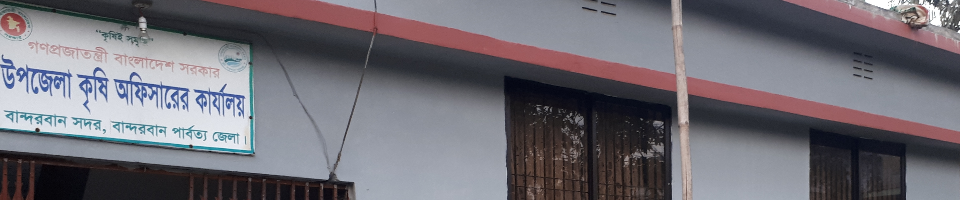
Bandarban Sadar is one of the largest and distinguished upazilas of Bandarban Hill District. Bandarban Sadar was established as a police station in 1923. It was upgraded to the upazila in 1983. Diverse ethnic groups, rows of hills, broad plain lands and the Sangu River (Sankh river) flowing through the middle of it has made the Jan-Prakriti unique in the upazila. This upazila consists of 05 (five) union and 01 (one) municipality, spread over more than 500 square kilometers of area. Most of the attractive tourist centers of Bandarban district (Nilchal, Meghla, Shail Prayat, Gold Temple) are located in Bandarban Sadar Upazila.
2. Geographic contact:
Bandarban Sadar is located in the heart of Bandarban district on the southeast of Bangladesh.
Location: Bandarban Sadar Upazila is located at 21.55 ° to 22.2 ° North latitude and 92.08 to 92.20 degree East longitude.
Rajasthali upazila of Rangamati upazila on the north, south-lama upazila on the north, ruma and roangchhari upazilas on the east, Rangunia, satkania, Chandanaish and lohagara upazilas of Chittagong are situated on the west.
At a glance, Department of Agricultural Extension of Bandarban Sadar Upazila, Bandarban Sadar Upazila
General information:
Description of the order quantity quantity details
1 Total area 50199. Details of farmers' farm
2 forest area 34628 ha. Total peasant family 9054
3 wetlands 887 hectares: 610 big farmers
4 population (latest Adam Census) 92237 middle peasants 1835
5 male 49824 small farmers 1895
6 women 42413 marginal farmers 2,455
7 agricultural input assistance cards 9054 landless farmers 2259
The number of 8 mouas is 16
9 Number of unions 5
10 number of municipalities 1 food situation information
11 Number of blocks 23/16 (according to the reservation) San Population Food demand Food production Mentioned food intake / deficit
12 BCIC fertilizer dealer 6 people
13 retail fertilizer dealers, 15
14 vehicles motorcycle 05
15 Agriculture Environment Zone No. 29
16 insecticidal retail retail: 14 wholesale2
17 Agriculture Information and Communication Center 1 Land Use
18 The main river Sangu land type The amount of soil to accumulate in the soil (ha)
19 Horticulture Center 1 1 Highland water does not accumulate 37650
20 private nurseries 04, 2 medium high ground 0-90 cm 11044
21 research institutes 4 (BARI, SRDI, BSRI, HCRC) 3 medium low land 90-180 cm 1506
22 Agriculture related NGOs 6 4 low land 180-300 cm -
23 Bangabandhu National Award for Agricultural Award 3 Lowest Boundary Land Above 300 Cms -
Crop Land Info: Irrigation Information: Number Hector
Total cultivable land 5078 hect. 1 shallow tube well - -
2 net crop land 4274 hectare 2 power pump diesel - 161 electricity - 9 884
3 one crop land 2111 hex 3 number of dams 152 91
4 two cropped land 2080 hen 4 other 522
5 Three crop land 80 ha 5 Land under irrigation 1497
6 Total Crop Land 6514 Agricultural Agricultural Equipment
7 Permanent Falling 804 Ha 1 Power Tiller 106 2105
8 crop intensity 152% 2 tractors - -
Main crop information under major crops is the main crop formatting information
Ropa Aman 2600 H. Rabi Kharip-1 Kharip-2 Area of land (H) Net percentage of percentage (%)
Boro 1100 ha. Boro damaged plantation Aman 1100
Zoom 582 H. Falling Falling Amon 980 22.23
Roopa Aus 80 o Winter Vegetable Vegetable Fall 470 10.10
Ginger 212 oh Fallen ginger / turmeric fall 320 7.48
Yellow 166 h. Falling zoomed in 600 14.03
Winter vegetables 710 h. Winter vegetables falled Amon 522 5.90
Summer vegetables 358 hectares of falciform seed born Amon 90.11
Under the fruit, the fall of tobacco tobacco has fallen
Banana 564 Ha. Sprinkle flour in spices 60 1.40
Papaya 35 hectare of oil is 58. 1.35
Pineapple 160 HB Boro Ropa Aus Ropaamon 50 1.16
Mango 598 ha: corn grim
Stacked 755 hectare: Winter vegetables fall 10 to 0.23
Orange 52 O Lichi 104 H.
Other 1527
Total 3795 hey
1.1 Vision
With the introduction of food security, the agricultural agrarian production of the friendly, non-profit and tobacco producers in the predominant climate is different in order to accelerate the development of natural and semi-social development including natural resources.
1.2 Mission
By providing efficient, fruitful, decentralized, area-based, demand-based and integrated agricultural extension services, increasing the knowledge and skills of all the peasants, to ensure the promotion of sustainable and profitable crops, including socio-economic development, extension services and technical knowledge and skills of all the peasants. Increasing the socio-economic development of the country.


Planning and Implementation: Cabinet Division, A2I, BCC, DoICT and BASIS
Technical Assistance:
![]()
Developed By:
